
PaddlePoints is a brilliant tool to help you find new places to paddle and share your favourite places with others. Heading away for a holiday and fancy a paddle, check PaddlePoints. Fancy seeing your city from the water, check PaddlePoints. Want to find out if there is a pub or picnic spot on your local paddle route, check PaddlePoints. It really is a tool that can revolutionise your paddle planning. So here is our step by step guide on how to use PaddlePoints.
Find a PaddlePoint
There are many types of PaddlePoints across the country, signposting all sorts of useful information. From paddling routes, weirs, pubs, picnic areas, to delivery partners and clubs. Use the PaddlePoints map to find your local ones.

- From the GoPaddling homepage, select ‘Find Paddling’ then ‘Explore PaddlePoints’.
- Use the interactive map to locate the area you are looking to paddle in.
- Click on the icon that denotes what you are looking for. The legend for these can be found by clicking on the three horizontal lines on the right of the search box. Here you can also filter to only see certain icons.
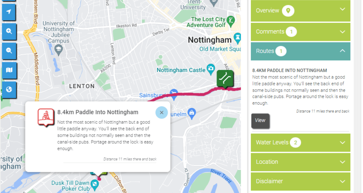
- If there is a route available you will see a ‘Routes’ section on the right of the map. Click that and click ‘View Route’. This will show you the route as it appears on a map. You will be able to see the rivers, canals, or lakes that it follows.
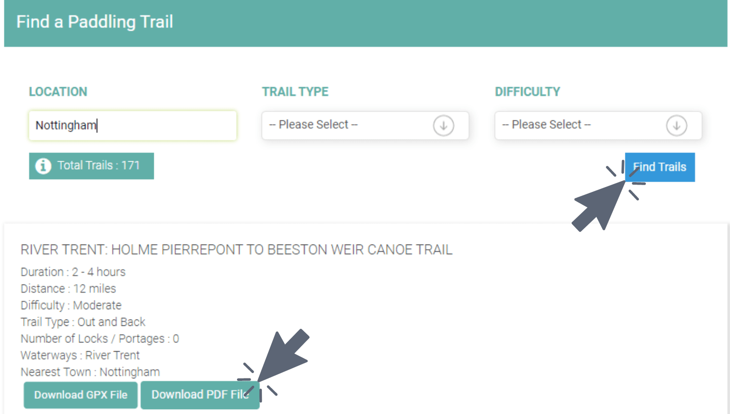
Download a route
You can download paddle routes that have been created by Paddle UK. The routes also have extra information about the paddle routes and the areas they pass through, adding a bit of learning to your paddling.

- To download a route map and information, click ‘Download Paddling Trails’ under the ‘Find Paddling’ menu title.
- Here you can search for the area you are wanting a trail map of, as well as the type of route and difficulty.
- When you search, routes of the area will come up with basic information on them. When you find the one you like the look of you can click ‘Download PDF File’ to get all the information and directions you may need.
- You can also download the routes as a GPX file to upload straight onto your navigation kit.
Comment on a PaddlePoint
If you have been out on a paddle and noticed a change to a PaddlePoint, or spotted something interesting along the way, you can let other paddlers know about this by leaving a comment on the PaddlePoint.

- If you want to leave a comment on a paddle route simply click the icon for the trail to bring up the side menu.
- Next to the ‘Comment’ title, you will see a ‘+’ button. Click this and comment away.
- You can even add a photo to your comment for all to see.
- Click save when you are finished.
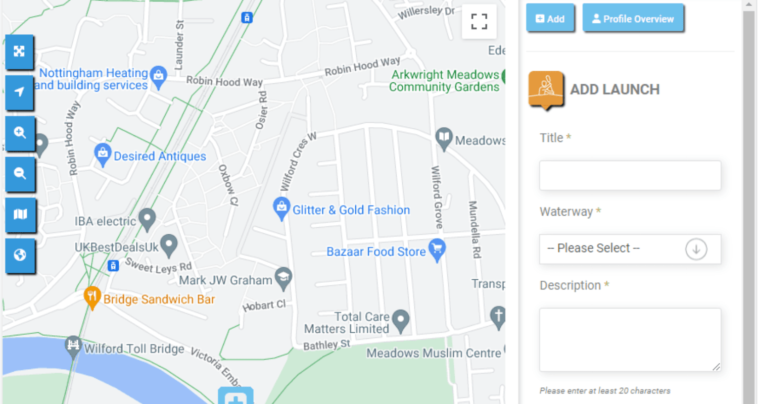
Add a PaddlePoint
If you have been paddling in your area and found a route or key point on the river, and you want to share this with other paddlers you can add it to the PaddlePoints map. This helps to grow the sport and gives others the chance to explore new areas.
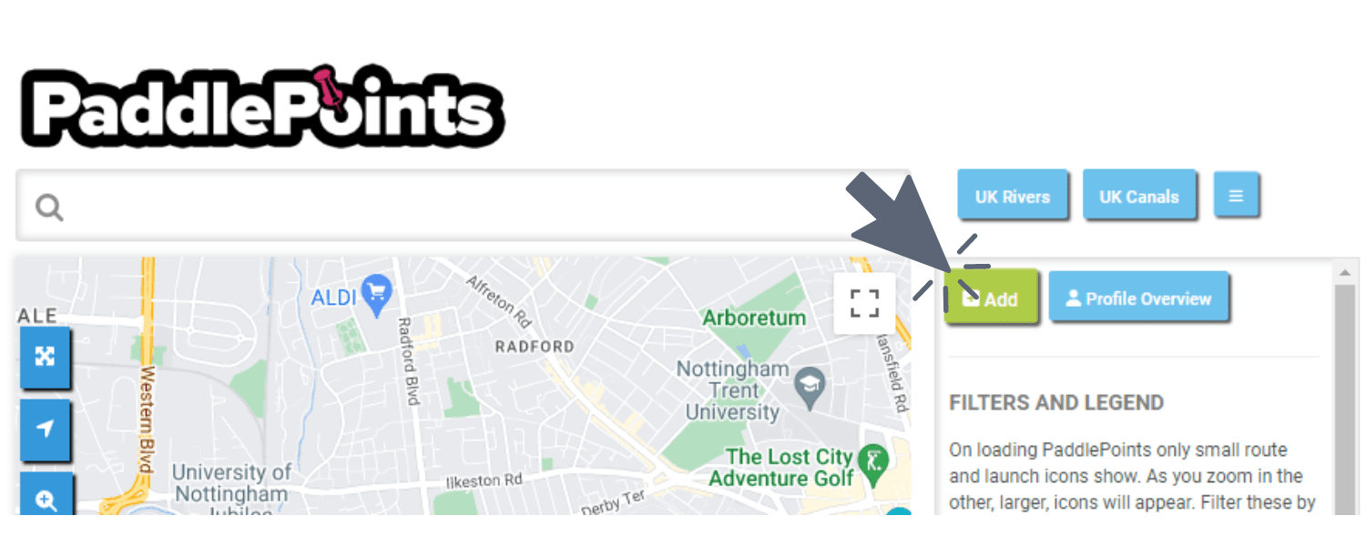
- On the PaddlePoints interactive map, click the three horizontal lines on the right hand side of the search bar. This will bring up the button labelled ‘+Add’. Click on that.
- Select what type of point you want to add. You can add anything from a route to a pub to a car park.
- This point will then appear on the map. Position it where needed.
- Once you have positioned the point, add all the appropriate details prompted on the right side of the map.
- Once completed click save!
Find out more and help the paddling community, join in a PaddlePoints Webinar or reach out to us via gopaddling@paddleuk.org.uk or contact Craig the Paddle Trails and Paddle Points content lead at Paddle UK.

 Paddle UK
 Go Paddling
 Clear Access Clear Waters
 Services Login

