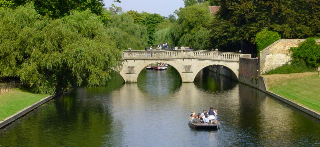
Measuring 43 miles in length, the River Cam is a beautiful paddle on a sunny day. The River Cam is one of Cambridge’s most popular features with tourists and residents alike. On a hot sunny day you will often see swathes of ‘punt’ boats occupying the river. As you paddle…
Crossing the border between Sussex and Cambridgeshire, the River Lark is a tributary of the River Great Ouse. It rises near Bury St Edmunds and joins the Great Ouse south of Littleport. It's 31 miles long, and has been used as a navigation since Roman times. Paddle the River Lark…
The Swaffham Bulbeck Lode is another of the Cambridgeshire lodes. The canal or ‘lode’ joins the River Cam around 1.5 miles below Bottisham Lode. It measures just over 3 miles long to the hamlet of Commercial End. The hamlet is tiny, as suggested by the term hamlet, but absolutely beautiful…
Like the New Bedford River, the Old Bedford River is a relatively new navigation. It was designed to by-pass the River Great Ouse at the Fens in Cambridgeshire. The river is named after the fourth Earl of Bedford. Like its newer namesake, it is a relatively straight paddle, straight through…
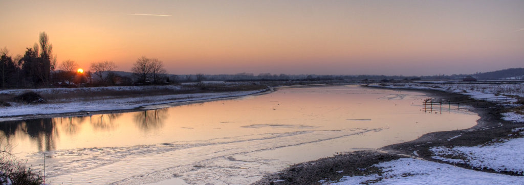
The “King of all Ouse’s,” the River Great Ouse runs for a whopping 143 miles! Starting life near Syresham and flowing through East Anglia, the river passes through the historic market town of Kings Lynn before entering the Wash. It has been historically important for trade but post-industrial revolution has…
Burwell Lode runs from the village of Burwell and joins Reach Lode less than 1 mile from the River Cam. A lode is a short, straight stretch of water, normally connecting a village to a major river. They are often described as dykes although they were built for navigation and…
One of the Cambridgeshire lodes, the Wicken Lode turns off Reach Lode, and crosses Wicken Sedge Fen. It then runs for nearly 1.5 miles to just short of the village of Wicken. The lode itself is quite narrow and shallow. It's perfect for a little paddle and means there are…
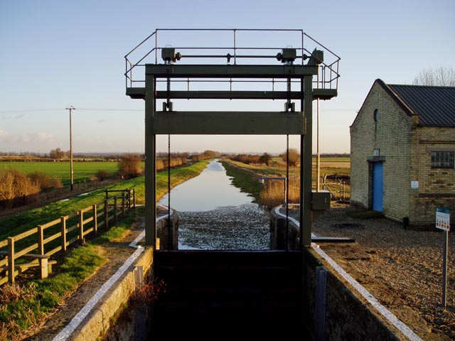
The Reache Lode is located in Cambridgeshire. It is one of the many ‘lodes’ in the area that eventually connect to the River Great Ouse before joining The Wash at Kings Lynn. First, the Reach Lode joins the River Cam at Upware though, before joining with a few of the…
Distance: 20.8 miles The 21-mile New Bedford River is a man-made by-pass of the River Great Ouse at the Fens in Cambridgeshire. It is a tidal stretch of river. You may also know it as the Hundred Foot Drain. This is because of the distance between the tops of the…
A river in East Anglia, the River Stour in Suffolk measures 47 miles long and is one of the more picturesque rivers in the region. It has been the subject of many painters over the years. These have included Thomas Gainborough, Alfred Munnings and Paul Nash. Probably the most noteworthy…
The Middle Level Commissioners welcome British Canoeing members on their navigation and we are pleased to now be included within British Canoeing Membership. The Middle Level Commissioners manage 160km of navigable waterways in the historic Fens of Cambridgeshire and Norfolk, providing a critical connection between the Environment Agency’s River Nene and River Great Ouse navigations.…
The Forty Foot Drain in Cambridgeshire is an artificial drainage river in Cambridgeshire. It is also known as Vermuyden's Drain Located in the Fens, in a relatively flat and exposed part of the country, it is only 10 miles long. Stretching between Wells Bridge, where it joins the River Nene,…
Another of the Ouses, The River Little Ouse is a tributary of the Great Ouse in the East of England, rising in Thelnetham on the Norfolk/Suffolk border, it pretty much traces the border all the way until it joins the Great Ouse at Brandon Creek, Littleport. The river stretches for…
Paddle UK Services Login
Please wait while we log you out of Paddle UK Services Login sites
Save over £80 on your waterways licences
Open up over 4,500km of waterways for as little as £29 a year
To canoe, kayak or paddle board on many rivers and canals you need a licence. Purchased individually, licences would cost you around £150.
Membership of Paddle UK offers you licences covering 4,500km of waterways in England and Wales for as little as £29-£60 per year. Learn more and join now using the button below.
British Canoeing membership comes with a waterways licence. So, Canoe, Kayak, or SUP, if you love paddling and care about waterways, join our community today.
Save money on a licence for 4,500km of waterways
Be covered by public liability insurance - plus discounts on craft insurance
If you're an England or non-UK resident seeking individual membership for the first time then use the British Canoeing RapidJoin service below. Start by entering your postcode, or country if you are non-UK.
Joining using RapidJoin below you'll purchase On The Water membership. You can find the full list of benefits here. You will be asked your date of birth and allocated the correct membership type for your age. Prices are:
Your personal data will only be used for administering your application and providing you with your membership services. Please see the British Canoeing Privacy Centre here for more details on how we manage your data.
Member Add-Ons - One Time Offer!
As a joining member you can benefit from discounts on paddling magazines. These offers are ONLY AVAILABLE NOW. They will cost you more if you purchase them in future. Don't miss out. Take the opportunity to benefit from these great deals now.
Accidental damage included. Excludes denting and bruising while in transit
No perks! Are you sure...?
Sorry to interrupt your flow. But, before moving to payment, we just wanted to check that you didn't want any member add-ons.
It's the last time you'll be able to purchase great paddling magazines with discounts? They offer advice that helps you get the most from your paddling.
Use the back button below so you don't miss out. Or hit the next button to go to payment.
Welcome to British Canoeing
You should receive your membership pack through the post in the next 7 days. But you can get on the water today. Download your card as a PDF using the button below, and use it as proof of your membership and waterways licence.
Your membership number is 123456
Please spend a few seconds to let us know how we are doing. Your feedback will help us improve.