Erewash Canal Part 1: Langley Mill to Ilkeston Paddle Trail

Erewash Canal Part 1: Langley Mill to Ilkeston Paddle Trail

1-2 hours
Duration
5 miles
Distance
One Way
Easy
Difficulty
NG16 4AA
Start Postcode
DE7 5BB
End Postcode
A. The Erewash Canal tracks along the border of Nottinghamshire and Derbyshire, meandering through the countryside, and around the edges of the area's towns and villages. In some parts urban, some parts rural, the canal plots a course through the area's natural and cultural heritage. This trail covers the top section of the canal, heading from the village of Langley Mill through to Ilkeston as it passes through the Erewash Valley.

B. On-road parking is available on Linkmel Road, by the Great Northern Pub. Access to the canal can be gained by walking a short distance on the main road past the pub, taking the second entrance to the canal basin by descending the steps to the canal below the lock. Enter the water just past the road bridge (by KFC).

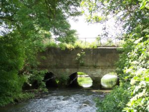
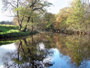
C. Soon after beginning the trail, the scenery opens out leaving industrial units behind and heading into open countryside, with views across the Erewash Valley. The River Erewash tracks close by the canal here, usually not much more than a shallow stream. After passing the two bridges, you begin to approach Eastwood Lock (No 73). The countryside to the left here was once occupied by Eastwood Colliery.

D. The colliery (closed in 1884) was served not only by the Erewash Canal but also the Nottingham Canal and a branch of the Great Northern Railway. Portage the lock on the towpath side, where the bank is low. The put-in point after the lock can either be done on the towpath side, down the grass bank, or by crossing the footbridge. The second option is usually the easiest, especially after wet weather. As you set off again, note the remains of stone buttresses which once held the viaduct carrying the railway over the canal.

E. The canal crosses over the River Erewash as you begin to approach Shipley Lock. This area was once a thriving wharf, bringing coal down from Shipley Colliery.

F. Portage Shipley Lock (No 72) on the towpath side. To get back on the water, carefully cross the road where there is a much easier bank, rather than using the steeper bank between the road and lock. The canal continues traveling through open countryside. Soon the fields to the right give way to housing and playing fields, as the canal begins to track the outskirts of Ilkeston. To the left, you will begin to see the steel lattice construction of the Bennerley Viaduct. A Grade II* listed structure, the viaduct opened in 1878.

G. The next lock, shortly after passing Bennerley Viaduct, is Stenson's Lock (No 71). Paddle fairly close to the lock to take advantage of the low sides for portaging, with similarly low sides below the lock for the get-in point. Shortly after Stenson's Lock, you approach Ilkeston Town Football Club and arrive at Barker's Lock (No 70). Although a simple portage, the road which passes over the canal here can be busy, with poor visibility for drivers crossing the bridge. Where possible use the steps down and under the road bridge, which also brings you to the best place to re-enter the canal.

Accessibility

The route to the mill from the car park is along a tarmac drive and is level apart from an approximately 10% gradient over the flood bank hump in the drive.

Access to the water:

  • Uneven concrete
  • Designated parking
  • Mobility parking
  • Accessible toilet

Discover More

The trail below the Great Northern Basin at Langley Mill, with its moored boats, boat yard, and a restored Victorian pump house. Although now the terminus of the Erewash Canal, the basin actually sits on what was once the start of the Cromford Canal. It was once instead the place where three canals joined together, transporting coal, iron, and other resources from Derbyshire, the Peak District, and Nottinghamshire across the UK and beyond. The Cromford Canal ran from Cromford near Matlock, connecting with the High Peak Railway to Langley Mill — the present basin, lock, and the few meters of canal where this trail begins — actually represent fragments of the old Cromford Canal. The Nottingham Canal branched off from here, initially tracking the Erewash Canal before heading off to the city of Nottingham to connect with the Trent and Northern England. The Erewash itself connected with the Derby and Sandiacre Canal to enable goods to be transported to Derby and the West Midlands.

The Erewash Canal tracks along the border of Nottinghamshire and Derbyshire, meandering through the countryside, and round the edges of the area’s towns and villages. In some parts urban, some parts rural, the canal plots a course through the area’s natural and cultural heritage. This trail covers the top section of the canal, heading from the village of Langley Mill through to Ilkeston as it passes through the Erewash Valley.

Facilities at Langley Mill:

  • The Great Northern Public House – offers a range of food and drinks. If using their toilet facilities, please enquire at the bar and purchase a drink or food – Great Northern Public House

Facilities at Gallows Inn: There is a pub next to Gallows Inn Lock.

Both the Derby & Sandiacre Canal Trust and ECP&DA put a great deal of work into maintaining, restoring, and improving the canal system we paddle today and in helping create more canals to paddle on in the future. As membership organisations, paddlers can join them (or the Canal & River Trust’s ‘Friends’ scheme) and get involved to help these organisations secure a strong future for our waterways. The Erewash Canal Rangers also help to look after the waterway, running regular volunteer days and reporting issues. For more information visit Canal & River Trust Volunteer.

Licence Information

The waterways in this trail are managed by the Canal & River Trust, and it is a requirement for paddlers to hold a licence. Paddle UK’s On The Water membership includes an annual licence for here as well as other waterways.

When paddling, have your membership card with you as proof of licence; otherwise, you could face a fine. Get your digital membership card straight away with your licence and liability insurance included from www.paddleuk.org.uk.

JOIN PADDLE UK

Safety Information

We want you to have fun and a safe paddle! Here are some helpful tips to ensure you paddle responsibly and stay safe on your journey. Please take a moment to review these important safety tips:

– Always wear a correctly sized buoyancy aid

– Carry a mobile phone – in a waterproof case

– Tell Someone Where You’re Going

– Check the weather and conditions

– Know your limits

Check out some useful blogs and e-learnings on how to keep safe

Water Safety

Navigation eLearning

Tides eLearning

Weather eLearning

Environment

Wherever and however you paddle, our Paddlers’ Code helps to ensure we can all enjoy and share the water safely and protect our precious environment.

Don’t get sick doing what you love. We know water quality is a concern for many paddlers. Click here for some simple advice on water quality and how to protect yourself.

Get informed, stay safe and make good decisions by checking the National Storm Overflow Map

Paddlers can play a vital role in keeping our waters free of harmful non-native species. It is crucial you Check, Clean and Dry you boat and equipment to prevent the spread. Click here for more information on Invasive Non-Native Species.

For more environmental advice and guidance, see our Blue Space Blogs section on the Paddle UK website.

Video