
The water’s calling, and you want to grab a kayak and hit the nearest river or lake. But here’s the thing, finding the right spot is way harder than it should be. If you’ve ever googled “kayaking near me,” you know what I mean: endless rental ads, confusing directions, or places that sound good until you realize you have no idea where to launch.
That’s where PaddlePoints comes in. It’s built for paddlers in the UK, whether you’re brand new or basically live on the water, and it solves that age-old question: “Where do I actually go?”
Here’s how to make PaddlePoints your new favorite paddling partner.
What’s PaddlePoints?
PaddlePoints is an interactive map made by Go Paddling, part of Paddle UK. But don’t think of it like Google Maps with boats. This thing’s created by paddlers, for paddlers, and it’s packed with the kind of details you won’t find anywhere else. We’re talking rivers, canals, lakes, all over the country, with real info about how to access the water, what to watch out for, and what to expect when you get there.
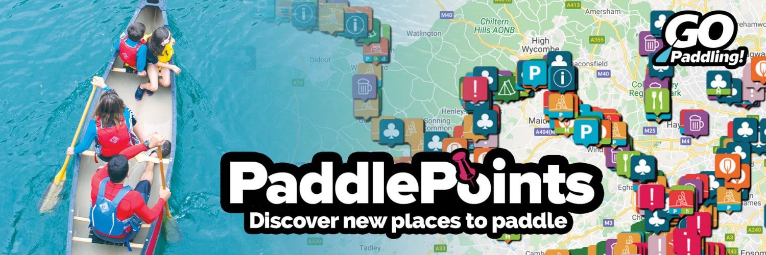
How to Find Your Next Paddle Spot with PaddlePoints
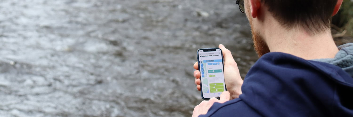
1 – Open the Map – Go to the Go Paddling website and jump into the PaddlePoints section. Right away, you’ll see a map dotted with all sorts of icons.
2 – Search Your Area – Type in your town, city, or postcode. The map zooms in and boom, every local paddling spot pops up.
3 – Understand the Icons – Not every bit of blue on the map is equal. PaddlePoints uses different icons to show what’s actually there.
-
-
- – Launch Points: These are the spots where you can get your kayak in or out of the water.
- – Hazards: Not every stretch is safe. PaddlePoints marks weirs, tricky locks, strong currents, stuff you really want to know before you show up.
- – Amenities: Want a car park nearby? Looking for a pub or a good picnic spot? These are marked too.
-
Click on any icon and you’ll usually get even more details, photos from other paddlers, updates about the spot, and honest comments about current conditions.
4 – Check Out Paddling Trails – If you want an easy, ready-made adventure, look for Paddling Trails. These are mapped routes, sometimes with downloadable guides or GPX files for your phone or GPS. Some are short and sweet, others are all-day trips. Honestly, starting with a local paddling trail is the easiest way to guarantee a good day out.
5 – Don’t Forget the Waterways License Layer – Here’s something a lot of folks miss: in the UK, you need a license for some inland waterways. PaddlePoints makes this easy by showing which routes need one (usually covered if you’re a Paddle UK member) and which are free to use.
Why PaddlePoints Beats a Normal Search
Regular search engines don’t know the difference between a sheer concrete wall and a gentle grassy bank. PaddlePoints does. Plus, you get the real scoop from other paddlers. Maybe someone just posted that the launch is blocked by nettles, or the best car park is closed for repairs. You don’t get that from a generic list of rental shops.
A Quick Word on Using PaddlePoints Responsibly
Remember, PaddlePoints is powered by the paddling community. That means anyone can add info, and while it’s a fantastic resource, it’s still up to you to check you’ve got the right to paddle and you’re not trespassing. Always read the latest comments and take a look around when you arrive.
Ready to Go?
Next time you feel like paddling, skip the endless searching. Jump straight to the PaddlePoints map, zoom in on your area, and find all the rivers, canals, and lakes just waiting for you. Get out there and enjoy the water.


