A .Park in the free parish car park and launch from the public slipway.
B. Paddle out on to Rockland Broad. The channel splits, and to the left the route takes you past the wherry graveyard known as The Slaughters. This is the name given to the remains of 16 wherries (old cargo sailing boats) that were sunk in Rockland Broad. Sometimes you can still see the timbers.
C. You can take either channel out onto the River Yare. The Fleet is the left hand channel and Short Dyke is the right hand one. From either dyke turn right on to the River Yare and start making the journey down to Loddon.
D. On the left hand side of the river is Strumpshaw Fen, which is owned and managed by the RSPB.
E. You can also see the tower of a former steam-powered drainage mill. The small structure on the left, Buckenham Ferry Drainage Mill, is used to maintain the water levels on the marsh.
F. Paddle down past the Beauchamp Arms and Buckenham Sailing Club on the right hand side of the river.
G. If you paddle down Langley Dyke (on the right at just over 3.5 miles) and moor up you can see parts of Langley Abbey from the lane. The abbey was founded in 1183 by the French Premonstratensian order of White Canons. The vaulted cellarers’ range still stands and there are the remains of the church, barn and ponds.
H. Back on the river, the vast structure in the distance is Cantley Factory which processes sugar beet. As the river winds its way towards Great Yarmouth the factory seems to move from one side of the river to the other.
I. Once past the factory the next mill, on the right, is Hardley Drainage Mill. A hundred years ago windmills like this one were a common sight, working alongside our rivers to drain the adjoining marshes. This windmill was capable of raising 12 tons of water per minute via a 12 foot high vertical shaft.
J. Continue and follow the river past Hardley Dyke. Beyond it, on the right, is Hardley Cross, a typical mediaeval boundary marker, but in an unusual position at the junction of the the Rivers Yare and Chet. The cross was erected in 1543 to mark the limit of the City of Norwich's control over the navigation on the Yare.
K. You are just over seven miles into your trip here and you turn right on to the River Chet. We don’t recommend canoeing further downstream on the Yare due to increased tidal flow which makes paddling difficult.
L. The river wends its way towards Loddon, passing Hardley Flood; an area of shallow lagoons and reedbeds formed in the 1940s when agricultural land flooded. Breaches in the riverbank allow tidal waters to move freely between the river and the marsh. At low tide much of the flood can dry out and this attracts many wading birds, including some nationally important breeding populations
M. Further up the Chet pass Pyes Mill, the site of two former mills.
N. Follow the river into Loddon where the staithe for mooring is ideally situated, with toilets and other facilities close at hand, including tea shops and pubs to provide a range of food and drink
O. 15. If you are finishing here there is a car park at Loddon Staithe, right beside your finish point. If continuing back to Rockland St Mary make sure you take time to enjoy Loddon before retracing your journey.
Discover More
Please check opening times and other details for places mentioned below. www.enjoythebroads.com
The River Yare was crucial for trade with Great Yarmouth and the wider world. Norwich established a water bailiff to collect fees on the track to and from Great Yarmouth. The bailiff was paid in goods that were seized if they had been traded without payment of the necessary fees.
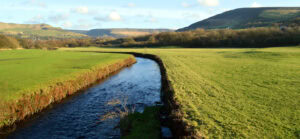
Spend a whole day paddling on the rivers Yare and Chet from the small and pretty village of Rockland St Mary to the popular market town of Loddon and back. If you’d rather a one way trip it’s possible to leave a car at Loddon and shuttle your craft back to the start.
Licence Information
The waterways in this trail are managed by the Broads Authority and it is a requirement for paddlers to hold a licence. Paddle UK’s On The Water membership includes an annual licence for here as well as other waterways.
When paddling, have your membership card with you as proof of licence; otherwise, you could face a fine. Get your digital membership card straight away with your licence and liability insurance included from www.paddleuk.org.uk.
We want you to have fun and a safe paddle! Here are some helpful tips to ensure you paddle responsibly and stay safe on your journey. Please take a moment to review these important safety tips:
Always wear a correctly sized buoyancy aid
Carry a mobile phone – in a waterproof case
Tell someone where you’re going
Check the weather and conditions
Know your limits
Check out some useful blogs and e-learnings on how to keep safe: Safe Paddle Blog
Wherever and however you paddle, our Paddlers’ Code helps to ensure we can all enjoy and share the water safely and protect our precious environment.
Don’t get sick doing what you love. We know water quality is a concern for many paddlers. Click here for some simple advice on water quality and how to protect yourself.
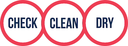
Paddlers can play a vital role in keeping our waters free of harmful non-native species. It is crucial you Check, Clean and Dry you boat and equipment to prevent the spread. Click here for more information on Invasive Non-Native Species.
For more environmental advice and guidance, see our Blue Space Blogs section on the Paddle UK website.
Before you create a PDF, you can if you like switch off elements you do not want, such as specific Paddle Points, and weather days.
Generating PDF.... Please wait
Paddle UK Services Login
Please wait while we log you out of Paddle UK Services Login sites
Save over £80 on your waterways licences
Open up over 4,500km of waterways for as little as £29 a year
To canoe, kayak or paddle board on many rivers and canals you need a licence. Purchased individually, licences would cost you around £150.
Membership of Paddle UK offers you licences covering 4,500km of waterways in England and Wales for as little as £29-£60 per year. Learn more and join now using the button below.
British Canoeing membership comes with a waterways licence. So, Canoe, Kayak, or SUP, if you love paddling and care about waterways, join our community today.
Save money on a licence for 4,500km of waterways
Be covered by public liability insurance - plus discounts on craft insurance
If you're an England or non-UK resident seeking individual membership for the first time then use the British Canoeing RapidJoin service below. Start by entering your postcode, or country if you are non-UK.
Joining using RapidJoin below you'll purchase On The Water membership. You can find the full list of benefits here. You will be asked your date of birth and allocated the correct membership type for your age. Prices are:
Your personal data will only be used for administering your application and providing you with your membership services. Please see the British Canoeing Privacy Centre here for more details on how we manage your data.
Member Add-Ons - One Time Offer!
As a joining member you can benefit from discounts on paddling magazines. These offers are ONLY AVAILABLE NOW. They will cost you more if you purchase them in future. Don't miss out. Take the opportunity to benefit from these great deals now.
Accidental damage included. Excludes denting and bruising while in transit
No perks! Are you sure...?
Sorry to interrupt your flow. But, before moving to payment, we just wanted to check that you didn't want any member add-ons.
It's the last time you'll be able to purchase great paddling magazines with discounts? They offer advice that helps you get the most from your paddling.
Use the back button below so you don't miss out. Or hit the next button to go to payment.
Welcome to British Canoeing
You should receive your membership pack through the post in the next 7 days. But you can get on the water today. Download your card as a PDF using the button below, and use it as proof of your membership and waterways licence.
Your membership number is 123456
Please spend a few seconds to let us know how we are doing. Your feedback will help us improve.