A. From the lay-by, carry craft along the left-hand side of the B4100, through a gate to the canal and launch just above the lock.
B. The canal passes under the first of many lift bridges, typical of the south part of the Oxford Canal. After a mile is the first M40 Bridge, but most of the scenery is rural, steep banks and trees on the left, flat grass fields and the River Cherwell on the right.
C. The first portage is at Kings Sutton Lock, a narrow twisty path close to the lock cottage. This is seriously remote, the only access other than the towpath being a narrow stony track a mile long. Kings Sutton railway station and the elegant church spire can be seen on the right, but there is no easy way to reach them.
D. A bit under a mile further on is Twyford Wharf, which has road access and limited parking.
E. Then comes Grants Lock (portage right), the M40 again and the southern approaches to Banbury. Look out for Roe Deer in the fields on the left; they are quite common round here.
F. Where the land flattens out on the left is Bankside Park, a good picnic spot, especially under the two huge weeping willow trees. Cool and peaceful on a hot sunny day.
G. Tramway Bridge, number 168, is handy for Morrison’s supermarket. Then follows half a mile of industry; Swan Foundry on the left, light industrial units on the right, walls topped with razor wire and broken glass, and in amongst it, a nice terrace of modern houses, the Sea Scouts and a kids’ nursery.
H. After bridge 166 is Banbury Lock. Land left to portage or right to stop at the Mill Arts Centre, which serves food and drinks. Banbury Lock is 5.5 miles from Nell Bridge and 4.5 miles from Cropredy.
I. On the left, above the lock, buried in a shopping centre, is a fascinating piece of canal history. Tooley’s Boatyard, a dry dock in a giant glass case. On the right is Spiceball Country Park, on the left the source of the best smell in Banbury: Fine Lady Bakeries.
J. Pass under and alongside two busy main roads, and then the canal bends to the right into the countryside.
K. On the right before the railway bridge and Hardwick Lock is Grimsbury Plantation, a nature reserve. Watch for kingfishers from here onwards.
L. Just above the lock you pass under the M40 for the last time and the canal becomes more peaceful. On this stretch you may encounter members of Banbury and District Canoe Club out training. There are two more locks to portage, the club is on the left immediately after Bridge 153.
Discover More
This ten-mile paddle links one of England’s narrowest canal bridges with the site of one of the Civil War’s bloodiest battles in 1644, along a placid canal, designed by James Brindley in the 18th Century. This section was opened in 1790 and follows the contours of the Cherwell Valley. There are many unusual lift bridges, found only on this canal, and there is little to spoil the tranquillity apart from occasional appearances by the M40 motorway and a short but interesting stretch through Banbury town centre. The scenery is varied and there is usually plenty of wildlife to be seen.
Start: Park in the lay-by off the B4100 near Nell Bridge Lock, near to The Pig Place farmshop; postcode OX17 3NU. It is easy to unload boats here but please be very discreet when changing.
Tooley’s Boatyard is near to where Tom Rolt and his wife had their narrowboat, Cressy, fitted out in 1939. Their voyage round the canals and rivers of England, and their book Narrowboat sparked a new interest in the canals, for leisure rather than work, led to the formation of the IWA (Inland Waterways Association) and helped to save the Oxford Canal and many others from closure. Banbury Museum (either side of the weird glass bridge) has some displays on the subject.
Finish: Please leave cars at the Sports and Social Club, which has a free car park about 200 metres east of the canal. Cross the canal bridge then the river bridge and the car park is on the right.
Licence Information
The waterways in this trail are managed by the Canal & River Trust, and it is a requirement for paddlers to hold a licence. Paddle UK’s On The Water membership includes an annual licence for here as well as other waterways.
When paddling, have your membership card with you as proof of licence; otherwise, you could face a fine. Get your digital membership card straight away with your licence and liability insurance included from www.paddleuk.org.uk.
We want you to have fun and a safe paddle! Here are some helpful tips to ensure you paddle responsibly and stay safe on your journey. Please take a moment to review these important safety tips:
– Always wear a correctly sized buoyancy aid
– Carry a mobile phone – in a waterproof case
– Tell Someone Where You’re Going
– Check the weather and conditions
– Know your limits
Check out some useful blogs and e-learnings on how to keep safe
Wherever and however you paddle, our Paddlers’ Code helps to ensure we can all enjoy and share the water safely and protect our precious environment.
Don’t get sick doing what you love. We know water quality is a concern for many paddlers. Click here for some simple advice on water quality and how to protect yourself.
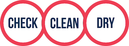
Paddlers can play a vital role in keeping our waters free of harmful non-native species. It is crucial you Check, Clean and Dry you boat and equipment to prevent the spread. Click here for more information on Invasive Non-Native Species.
For more environmental advice and guidance, see our Blue Space Blogs section on the Paddle UK website.
Video
Loading trail data....
Tide graph at
Before you create a PDF, you can if you like switch off elements you do not want, such as specific Paddle Points, and weather days.
Generating PDF.... Please wait
Paddle UK Services Login
Please wait while we log you out of Paddle UK Services Login sites
Save over £80 on your waterways licences
Open up over 4,500km of waterways for as little as £29 a year
To canoe, kayak or paddle board on many rivers and canals you need a licence. Purchased individually, licences would cost you around £150.
Membership of Paddle UK offers you licences covering 4,500km of waterways in England and Wales for as little as £29-£60 per year. Learn more and join now using the button below.
British Canoeing membership comes with a waterways licence. So, Canoe, Kayak, or SUP, if you love paddling and care about waterways, join our community today.
Save money on a licence for 4,500km of waterways
Be covered by public liability insurance - plus discounts on craft insurance
If you're an England or non-UK resident seeking individual membership for the first time then use the British Canoeing RapidJoin service below. Start by entering your postcode, or country if you are non-UK.
Joining using RapidJoin below you'll purchase On The Water membership. You can find the full list of benefits here. You will be asked your date of birth and allocated the correct membership type for your age. Prices are:
Your personal data will only be used for administering your application and providing you with your membership services. Please see the British Canoeing Privacy Centre here for more details on how we manage your data.
Member Add-Ons - One Time Offer!
As a joining member you can benefit from discounts on paddling magazines. These offers are ONLY AVAILABLE NOW. They will cost you more if you purchase them in future. Don't miss out. Take the opportunity to benefit from these great deals now.
Accidental damage included. Excludes denting and bruising while in transit
No perks! Are you sure...?
Sorry to interrupt your flow. But, before moving to payment, we just wanted to check that you didn't want any member add-ons.
It's the last time you'll be able to purchase great paddling magazines with discounts? They offer advice that helps you get the most from your paddling.
Use the back button below so you don't miss out. Or hit the next button to go to payment.
Welcome to British Canoeing
You should receive your membership pack through the post in the next 7 days. But you can get on the water today. Download your card as a PDF using the button below, and use it as proof of your membership and waterways licence.
Your membership number is 123456
Please spend a few seconds to let us know how we are doing. Your feedback will help us improve.